Pipeline Trail Hike: A Complete Guide to Boquete's Best Rainforest Walk
Pipeline Trail in Boquete is a 3.8-mile moderate rainforest hike taking 2-3 hours with $5 entry fee, features steady uphill climb (manageable for anyone who can walk briskly 30-45 minutes), hidden waterfall at the end, quetzal habitat where you might spot Central America's most beautiful bird, 1000-year-old cypress tree, and multiple stream footbridges ($2-2.50 collectivo from town center to trailhead, departs Parada de Buses Pequeños every 40 minutes). Start by 8 AM to finish before 2 PM afternoon rains, bring 2 liters water, good hiking shoes (trail gets muddy in rainy season), rain jacket, and insect repellent for this genuinely spectacular rainforest experience.
Quick Overview
Distance: 3.8 miles round trip
Difficulty: Moderate (steady incline going up, mostly downhill returning)
Time Required: 2-3 hours
Best Time: Early morning (finish before 2 PM when afternoon rains typically start)
Cost: $5 USD entry fee + $2-2.50 USD for collectivo transport
Reward: Hidden waterfall, quetzal habitat, 1000-year-old tree, and beautiful forest scenery
Why Hike the Pipeline Trail?
The Pipeline Trail offers something special that makes it stand out among Boquete's many hiking options. It's challenging enough to feel like a real hike, but not so difficult that you need extreme fitness. The trail passes through protected rainforest habitat where you have a legitimate chance of spotting a quetzal, one of Central America's most beautiful and elusive birds.
You'll cross multiple footbridges over streams, walk past a 1000-year-old tree that reminds you of the scale of this ecosystem, and ultimately reach a hidden waterfall tucked away in the forest. It's genuinely worth the effort.
Getting There: Transportation
From Boquete town center:
Head to the Parada de Buses Pequeños (small bus station) in downtown Boquete. This is where collectivos (shared minibuses) depart for outlying areas. Look for a vehicle marked with "Bajo Mono" or ask one of the drivers, they know where the Pipeline Trail access point is.
Cost: $2-2.50 USD one way
Travel time: About 20 minutes
Return service: Collectivos depart from a sheltered bus stop near the trail every 40 minutes or so. Plan to catch one in the early afternoon so you're not stranded.
Pro tip: Confirm the last collectivo departure time with the driver on your way up. This matters for planning your hike duration.
Trail Difficulty & Fitness Requirements
The Pipeline Trail is moderate difficulty. Going uphill, you face a steady incline, not brutal, but consistent. You'll be breathing harder, and your legs will feel it, but you don't need to be a marathoner to complete this hike.
On the return trip, it's mostly downhill, which is easier on your cardiovascular system but harder on your knees. Bring trekking poles or a walking stick if you have joint concerns, they make a real difference on descents.
Realistic fitness assessment: If you can walk briskly for 30-45 minutes without stopping, you can do this hike. Pace yourself, take breaks at the benches along the trail, and you'll be fine.
What to Bring
- Water: Bring at least 2 liters. The trail has stream crossings, but you shouldn't drink untreated water. Bring a filter or pre-fill bottles.
- Good footwear: Trail sneakers or hiking boots. In dry conditions, good sneakers are sufficient, but hiking boots provide better ankle support. The trail can be muddy or slippery in places.
- Rain gear: Even if it looks clear in the morning, bring a light rain jacket. Mountain weather changes fast, and afternoon showers are common.
- Snacks: Energy bars, fruit, or trail mix. You'll be hiking for 2-3 hours.
- Binoculars (optional): If you're interested in bird watching, bring them. Quetzals are more likely to be heard than seen, but binoculars help.
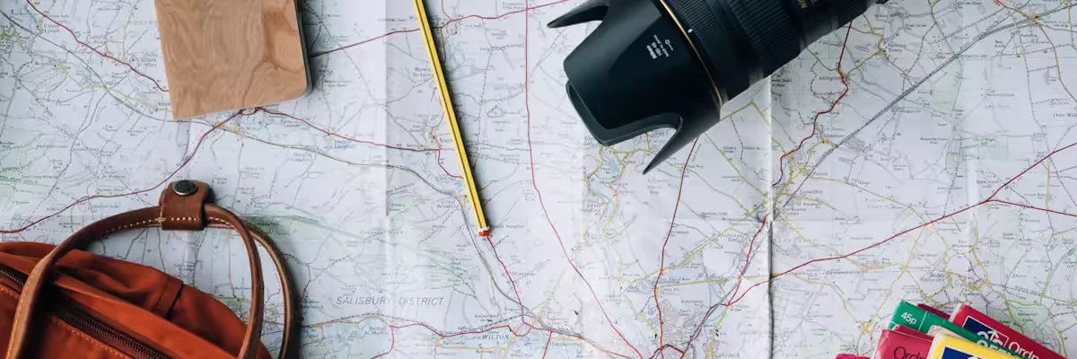
- Camera: There are genuinely photogenic moments, the footbridges, the forest, the waterfall.
- Sun protection: Hat, sunscreen, and sunglasses. Even in the forest, UV exposure is real.
- Insect repellent: Mosquitoes exist. A good DEET-based repellent is your friend.
The Route: What to Expect
Starting Section: Gravel Road & Stream
You begin on a gravel road walking alongside a stream. This section is easy and gives you a chance to warm up and get into a rhythm. The noise of the stream is peaceful, and you'll notice the forest getting denser as you progress.
Middle Section: Forested Footpath
The trail transitions from the gravel road to a proper footpath winding through the rainforest. This is where the real beauty starts. Benches are placed strategically for rest breaks, take them if you need them. There's no shame in a 5-minute breather when hiking at elevation.
This section includes the designated quetzal habitat area. If you're quiet and observant, you might spot one. Most hikers hear the distinctive call before seeing the bird, so listen carefully. Quetzals are stunning, emerald green with a crimson chest and long tail feathers.
The 1000-Year-Old Tree
You'll pass an ancient cypress tree estimated to be around 1000 years old. Standing next to it is humbling. This tree has been alive through centuries of history, and it's still growing here in the Boquete highlands. Take a moment to really look at it and appreciate the scale of time.
Final Approach: Steep Climb to the Waterfall
The final stretch to the waterfall involves steeper climbing over the last 10-15 minutes. Your legs will feel this section, but the payoff is genuine, a beautiful hidden waterfall tucked away in the forest. The water is cold and refreshing. Many hikers take off their shoes and soak their feet. Some brave souls actually swim in the pool at the base.
Spend 20-30 minutes here resting and enjoying the moment. You've earned it.
Practical Hiking Tips
Start Early
Leave Boquete by 8 AM at the latest. You want to finish the hike before 2 PM when afternoon rains typically begin. Starting early also gives you better light for photography and bird watching, and you'll have first choice of collectivos on the way down.
Weather Considerations
In dry season (January-March), the trail is well-maintained and relatively easy to navigate. In rainy season (May-December), the path can be muddy and slippery. The trail is well-drained overall, but don't hike immediately after heavy rain, the increased water flow makes footing treacherous.
Register at the Trailhead
There's typically a logbook where you sign in. This isn't just bureaucracy, it's a safety measure. If something happens, people know someone is on the trail.
Go at Your Pace
Hiking isn't a race. Move at a pace where you can still talk comfortably (or breathe comfortably if you're alone). The goal is to enjoy the forest, not prove your fitness. Taking breaks is fine and normal.
Respect the Forest
Take all trash with you. The trail is pristine because people respect it. Don't pick plants, disturb wildlife, or deviate from the marked path. This rainforest is delicate and special.
Quetzal Spotting: Reality vs. Expectations
I mention the quetzal because it's a big draw for this trail. Real talk: spotting a quetzal isn't guaranteed. They're real birds, not mythical creatures, and they don't appear on command. Boquete's higher elevations are part of their range, but "likely to see one" doesn't mean "you will definitely see one."
That said, if you're quiet, patient, and hiking during the right seasons (breeding season is their most vocal period), your chances are decent. Even if you don't see a quetzal, the hike is still spectacular. Don't let that be your only reason to come.
After the Hike
You'll be tired and your legs will likely be sore the next day. Treat yourself, stop for a coffee or meal in town, take a warm shower back at your accommodation, and rest. You've done a real hike, not a casual walk.
Consider spending your afternoon at a local café in Boquete, reviewing your photos and sharing stories with other travelers. The hiking community here is friendly and social.
Related Boquete Hiking Resources
Frequently Asked Questions
How long is the Pipeline Trail hike in Boquete?
Can you see quetzals on Pipeline Trail?
When is the best time to hike Pipeline Trail?
How do I get to Pipeline Trail from Boquete?

 From Seattle, United States
|
From Seattle, United States
|  Living in Boquete, Panama
 Seattle → Boquete. Coffee farms over coffee shops. Hikes over happy hours. Here to share what I've learned about sustainable expat living in Panama's highlands.
View Full ProfileFound this helpful?
Join the conversation. Share your own tips, experiences, or questions with the expat community.
Your blog could reach thousands too
More Blogs About Boquete
Report an Issue
Help us improve our listings
Report Submitted
Thank you for helping us maintain quality listings. We'll review your report shortly.
Submission Failed
Something went wrong. Please try again.
Sign In Required
Please sign in to report an issue. This helps us follow up on your report if needed.